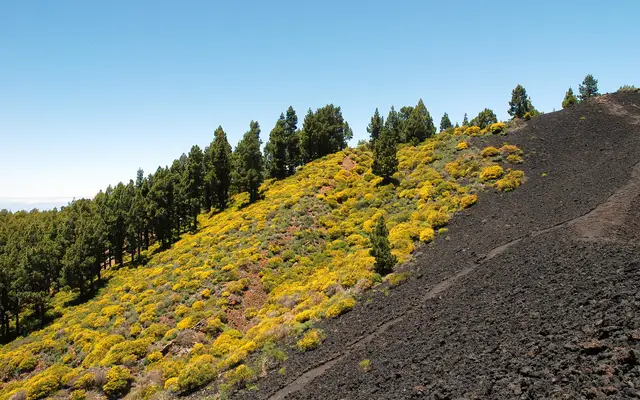
If you are wondering what to do in La Palma (the island, not Las Palmas on Gran Canaria or Palma de Mallorca), start by accepting what it is: a vertical island, green in the north and black with lava in the south, where almost everything worth doing is done on foot or looking upwards. The whole island has been a Biosphere Reserve since 2002, and in 2012 it became the first place in the world to be certified as both a Starlight Reserve and a Starlight Tourist Destination.
Of its visitors, 57.6% go walking and 17.3% go out stargazing, far more than on any other island. For a week on the beach with a hotel right on the sand, Tenerife or Gran Canaria will suit you better.
La Palma at a glance: who it's for
You'll love it if you walk. The GR 131, "El Bastón", climbs from Puerto de Tazacorte to the Roque de los Muchachos and follows the ridge down to Fuencaliente; the GR 130 circles the island along the Camino Real in eight stages. For how it compares with the other islands, see hiking in the Canary Islands.
It's not your island if you want guaranteed sunshine and easy beaches. La Palma airport is the rainiest coastal weather station in the archipelago (369 mm and about 40 days of rain a year) and the one with the least sunshine. The beaches are black sand with heavy swell, and Puerto Naos, the main one, is still reopening in phases.
Places to visit in La Palma: the highlights, area by area
Caldera de Taburiente and the La Cumbrecita permit
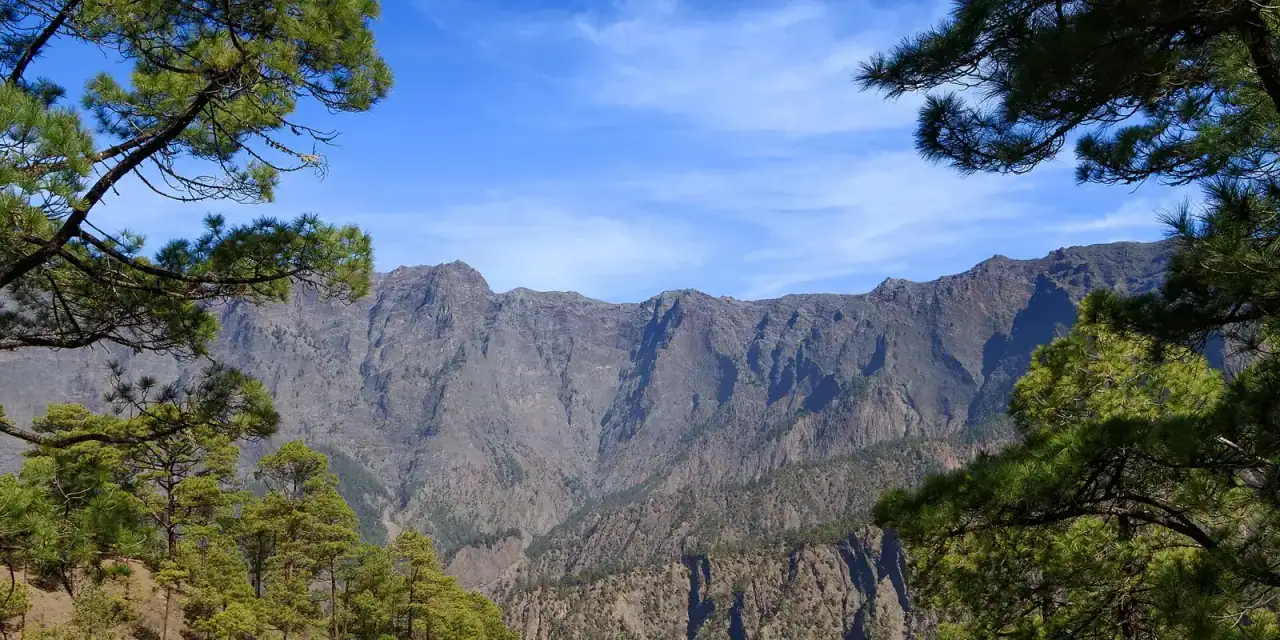
The national park covers 4,690 hectares around a vast basin 8 km across. Entry is free, but to drive up to La Cumbrecita between 08:30 and 16:00 you need a free parking permit from reservasparquesnacionales.es, issued in 30-minute slots and no more than a month in advance. The barrier lets you through from 10 minutes before to 20 minutes after your slot; any later and the booking lapses.
From the car park, a flat 1 km track leads to the Mirador Lomo de las Chozas (a 1-hour booking is enough). For the 90-minute viewpoint circuit, book 2 hours: anyone who fails to cancel, turns up late or overstays is barred from booking for a year.
To get down into the Caldera, the classic walk is Los Brecitos → campsite → Barranco de las Angustias. You can't park at Los Brecitos: leave the car at Las Angustias and take one of the taxis waiting there in the morning (in winter, the last one leaves at 12:00). At the time of writing the Cumbrecita–campsite section is closed, and the way out through Las Angustias shuts with any rain pre-alert: check the park's trail status. The visitor centre is in El Paso, and the Santa Cruz–Los Llanos bus stops in its car park.
Roque de los Muchachos and the observatory
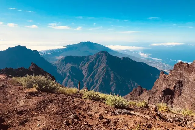
The island's highest point, at 2,426 m, is a free, tarmacked viewpoint on the rim of the Caldera. At 2,396 m, the Instituto de Astrofísica de Canarias runs the observatory that houses the Gran Telescopio Canarias, the world's largest optical-infrared telescope. It can be visited by day and only with a guide: everything is in our Roque de los Muchachos guide. There's no bus and no petrol station at the top: fill up before you take the LP-4.
Los Tilos and Marcos y Cordero: the laurel forest
Los Tilos, in San Andrés y Sauces, became the island's first Biosphere Reserve in 1983. Marcos y Cordero (12.5 km, 13 water tunnels) is the most famous laurel-forest walk; it starts at Casa del Monte, which jeeps reach from Los Sauces (616 41 88 47). Check it's open on the island's trail status page. For something shorter, the Cubo de La Galga (Puntallana) is a circular and very accessible walk.
The Volcano Route and the south: San Antonio, Teneguía and the salt pans
The Ruta de los Volcanes is the stage of the GR 131 between the Refugio de El Pilar and Fuencaliente: 23.7 km one way along the Cumbre Vieja ridge. To get back to your car, taxis run from Fuencaliente to the Refugio (619 45 46 53).
In Fuencaliente, the San Antonio Volcano Visitor Centre (€8, under-12s free) has a path of about 30 minutes around the crater rim. Further south is Teneguía, which erupted on 26 October 1971, and at the tip of the island the Salinas de Fuencaliente, salt pans that still produce flor de sal and are a stopover for migrating birds.
Tajogaite volcano
The 2021 eruption lasted 85 days and covered 1,219 hectares. You can only reach the cone with an authorised company, on a circuit of about 6 km; the viewpoints at Las Manchas, Tajuya and Puerto de Tazacorte are open to all. Everything is in the Tajogaite volcano guide; the other islands are in volcanoes of the Canary Islands.
Natural pools and beaches
Charco Azul (San Andrés y Sauces) has seawater pools, one with a flat bottom for children, plus showers and parking. La Fajana (Barlovento) is three linked pools with restaurants. Both are summer facilities: when the swell is up in winter they can be unusable. Playa de Nogales (Puntallana) is 450 m of black sand below a cliff, with strong waves.
Santa Cruz de La Palma
The capital was founded in 1493 and in the 16th century was considered the third port of the empire, after Antwerp and Seville. The whole old town is a listed historic ensemble, with wooden balconies facing the sea and Flemish art in the churches. The Museo Naval is inside the Barco de la Virgen, a replica caravel in the Plaza de La Alameda; it is the most visited museum on the island.
The west coast: Tazacorte, Porís de Candelaria and Puerto Naos
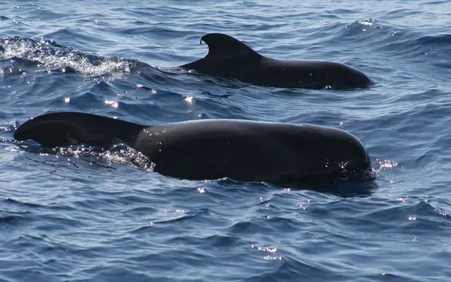
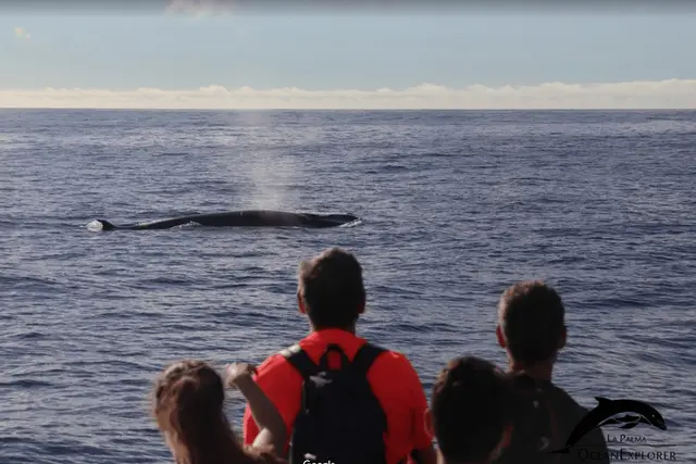
Puerto de Tazacorte is the harbour for boat trips: every boat licensed for whale and dolphin watching on the island sails from here (we compare them in whale watching in La Palma). The Porís de Candelaria (Tijarafe), a cluster of white cottages inside a 50 m high sea cave, is also easy to reach by boat.
The coast road from Tazacorte to Puerto Naos crosses the 2021 lava for 2.4 km: it's the only place where you drive over the lava flows.
- 1Santa Cruz de La PalmaportDirections ↗
- 2La Cumbrecitanature areaDirections ↗
- 3Roque de los MuchachospeakDirections ↗
- 4Los Tilosnature areaDirections ↗
- 5Charco AzulbeachDirections ↗
- 6Volcán TajogaitepeakDirections ↗
- 7Caños de FuegosightDirections ↗
- 8Puerto de TazacorteportDirections ↗
- 9Refugio de El Pilarnature areaDirections ↗
- 10Salinas de FuencalientesightDirections ↗
Where to stay on a walking holiday in La Palma
- Los Llanos de Aridane and El Paso: best for the Caldera (La Cumbrecita, Las Angustias and its taxis), Tajogaite and the Refugio de El Pilar.
- San Andrés y Sauces or Barlovento: for Los Tilos, Marcos y Cordero and the northern stretch of the GR 130. Charco Azul, La Fajana and the Ron Aldea distillery are close by.
- Fuencaliente: the end of the Volcano Route, the southern volcanoes, the salt pans and the wineries.
- Santa Cruz and Los Cancajos: 10 minutes from the airport and the starting point for stargazing tours.
Excursions in La Palma: our picks
With a car you can do almost everything on your own; tours are worth it for the Tajogaite cone (guide compulsory), the boat from Tazacorte and, if you don't drive, a day round the island by coach.
Our pick
1
Tajogaite with a certified guide
The official route to the cone, which you can't do on your own; one of the best rated.
GetYourGuide4 hours
Tajogaite Volcano: the official route with a certified local guide
4.9 (545 reviews)
from €37Check availability
2
The island in a day without a car
An 8–9 hour guided coach tour, for anyone who'd rather not drive mountain roads.
GetYourGuide8 - 9 hours
La Palma: Island Highlights Guided Bus Tour
4.6 (332 reviews)
from €42Check availability
3
Whales and dolphins from Tazacorte
Three hours along the more sheltered west coast, with a marine biologist.
GetYourGuide3 hours
La Palma: Whale & Dolphin Tour with Marine Biologist
4.5 (1,166 reviews)
from €60Check availability
4
The Roque on foot
A 4-hour guided walk along the summit, rather than just peering over from the viewpoint.
GetYourGuide4 hours
La Palma: Guided Trekking Tour to El Roque de los Muchachos
4.8 (141 reviews)
from €32Check availability
5
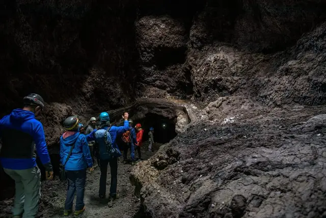
Inside the Cueva de Las Palomas
A 1949 lava tube you can only visit with an authorised company; helmet with lamp included.
GetYourGuide2 hours
La Palma: Cueva de Las Palomas Volcanic Tube
4.7 (696 reviews)
from €25Check availability
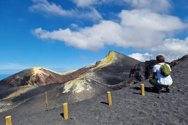
GetYourGuide4 hours
La Palma: Tajogaite Volcano Guided Trek
4.8 (2,198 reviews)
from €38Check availability
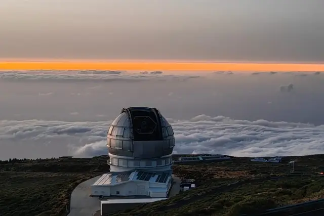
GetYourGuide6 - 7 hours
La Palma: Roque de los Muchachos Stargazing Tour with Wine
4.4 (708 reviews)
from €55Check availability
GetYourGuide2 hours
La Palma: Cueva de Las Palomas Volcanic Tube
4.7 (696 reviews)
from €25Check availability
GetYourGuide4 hours
La Palma: Guided Trekking Tour to El Roque de los Muchachos
4.8 (141 reviews)
from €32Check availability
GetYourGuide4 hours
Tajogaite Volcano: the official route with a certified local guide
4.9 (545 reviews)
from €37Check availability
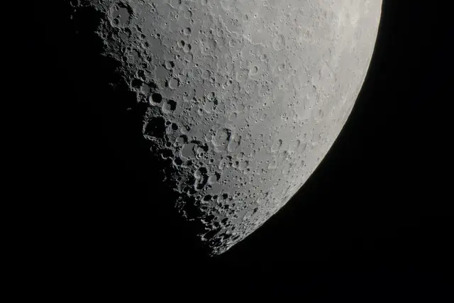
GetYourGuide1.5 hours
La Palma: Premium Stargazing Tour for 10
4.2 (65 reviews)
from €75Check availability
See all options on GetYourGuide →Prices checked on 2 October 2026
How to get to La Palma and get around
By air. Binter and Canaryfly fly from Tenerife North and Gran Canaria in 30–45 minutes; Iberia Express and Vueling link it with Madrid and Barcelona all year. There are direct flights from the UK, Germany, Switzerland and the Netherlands, some of them seasonal only.
By ferry. From Los Cristianos (south Tenerife) to Santa Cruz de La Palma takes about 2 h 30 with Fred. Olsen and with Baleària Canarias, formerly Naviera Armas. Baleària advertises fares from €55; the €12–14 tickets you'll see are Canary Islands resident fares, which visitors can't use. Every combination is in getting between the islands.
On the island. You need a car. The bus (guagua, run by TILP) reaches every municipality and line 300 links Santa Cruz, El Paso and Los Llanos, but no bus goes up to the Roque de los Muchachos. From the airport to Puerto Naos is 40 km and an hour; by taxi, about €45–48. To Los Cancajos, €7–9.
When to go to La Palma: the weather
| Jan | Feb | Mar | Apr | May | Jun | Jul | Aug | Sep | Oct | Nov | Dec | |
|---|---|---|---|---|---|---|---|---|---|---|---|---|
| High °C | 21 | 21 | 21 | 22 | 23 | 24 | 26 | 26 | 27 | 26 | 24 | 22 |
| Low °C | 16 | 15 | 16 | 16 | 17 | 19 | 21 | 21 | 21 | 20 | 18 | 17 |
| Sea °C | 20 | 20 | 19 | 20 | 21 | 22 | 22 | 23 | 24 | 24 | 23 | 21 |
| Rainy days | 5 | 4 | 4 | 3 | 1 | 0 | 0 | 0 | 2 | 5 | 7 | 8 |
| Hours of sun a day | 5 | 5 | 6 | 6 | 6 | 6 | 7 | 7 | 6 | 6 | 5 | 5 |
Source: AEMET, climate normals (1981–2010) · sea temperature: seatemperature.info, ten-year average
La Palma is mild all year: on the coast, highs of about 21 °C in January and 26 °C in August, with winter nights (15.5 °C) among the warmest in the Canaries. The sea reaches about 24 °C in September and October. What changes is the rain: it returns in October, and December brings 80 mm over eight days.
Those figures come from the airport, on the east coast, the windward side that catches the trade winds and their clouds. The west side (Los Llanos, Tazacorte, Puerto Naos) is in the lee and tends to be drier and clearer. On the summit, temperatures drop below freezing in winter. Compare the islands month by month in Canary Islands weather.
Between autumn and spring, ask about the state of the ravines before going into the Caldera; in summer, fire alerts can close the forests. For the night sky the Moon is what matters: we explain it in stargazing in the Canary Islands.
Festivals in La Palma: when they fall
- Bajada de la Virgen de las Nieves (Santa Cruz): not an annual event. It is held every five years, in years ending in 0 and 5, from June or July to 5 August, with the famous Dance of the Dwarves (Danza de los Enanos).
- Los Indianos (Santa Cruz): on Carnival Monday, everyone dresses in white for a battle of talcum powder. The date moves with Easter, so it falls between February and March.
- Transvulcania: an ultramarathon of just over 73 km with 8,500 m of cumulative climb, from the Fuencaliente lighthouse to Los Llanos de Aridane; it's run in May.
- La Palma Walking Festival: three days of guided walks in mid-September.
Common mistakes in La Palma
- Driving up to La Cumbrecita mid-morning without a permit. The barrier won't let you through: book, or go up after 16:00 without a booking (in summer the information hut stays open until 20:00).
- Starting a long walk after midday, or heading down into the Caldera in rain or wind: the park advises against it because of rockfalls.
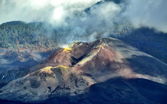 La PalmaTajogaite volcanoYou can only reach the Tajogaite volcano cone with an authorised guide: a 6 km hike for €30–48. Free visits to viewpoints, Caños de Fuego and lava by boat.from €25
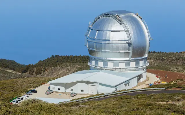 La PalmaRoque de los MuchachosThe Roque de los Muchachos observatory tour runs by day and costs €20; there's no night entry. Visitor centre, opening hours and La Palma stargazing spots.from €32
What to do in La Palma in 3 days?
One day for the Caldera de Taburiente, another for the Roque de los Muchachos and the west coast, and the third for Tajogaite with a guide and the southern volcanoes. With a hire car it all fits.
What to do in La Palma in 7 days?
Add Los Tilos and Marcos y Cordero, the Volcano Route, Santa Cruz, the boat from Tazacorte and a night of stargazing. Switching base halfway through the week saves time on the road.
What are the best things to do in La Palma with kids?
The children's pool at Charco Azul, the Barco de la Virgen in Santa Cruz and the rim of the San Antonio volcano, which takes half an hour to walk round. Under-12s go free at the Cabildo centres.
How do you get from Tenerife to La Palma?
By air from Tenerife North (about 30–45 minutes) or by ferry from Los Cristianos, about 2 h 30 with Fred. Olsen or Baleària Canarias. If you're staying in the south of Tenerife or travelling with a car, the ferry is usually the better option.
Do you need a permit for the Caldera de Taburiente?
Not to walk in, and there's no entry fee. You do need a free permit to park at La Cumbrecita between 08:30 and 16:00, and another to stay at the campsite.